Dubai Municipality completes the Middle East's first innovative mobile mapping survey of waterways
Last Update: Monday, May 11, 2026 : 16:30 (+4GMT)

- A landmark achievement that strengthens Dubai Municipality’s advanced geospatial ecosystem through the adoption of cutting-edge waterway surveying technologies
- Innovative technology enhances the accuracy of geospatial data and supports urban planning, the Digital Twin project, and smart decision-making
- High-precision 3D models developed for Dubai Water Canal in Al Jaddaf
- Expansion plans underway to survey waterways across the emirate within an integrated digital framework
Dubai, United Arab Emirates, 11 May 2026: In a step that reflects Dubai’s commitment to adopting the latest smart technologies to strengthen advanced digital infrastructure, Dubai Municipality has completed the Middle East’s first pilot project for surveying waterways and canals using Mobile Mapping technology through the Leica TRK system mounted on a specially equipped vessel.
The achievement represents a significant addition to Dubai’s geospatial ecosystem, recognised among the most advanced and efficient globally, by providing highly accurate and continuously updated spatial data that supports vital sectors, enhances asset management, and strengthens sustainable urban planning.
The pilot project included advanced surveying works across Dubai Water Canal in Al Jaddaf, where highly detailed datasets were captured and high-precision 3D models were developed in collaboration with specialised partners. The project opens wider opportunities to utilise advanced geospatial datasets to improve infrastructure management efficiency and support the planning and development of urban projects in line with international best practices.
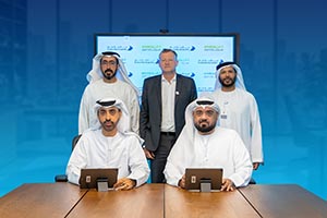
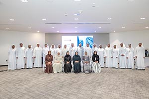
Eng. Maitha Alnuaimi, Director of the GIS Centre Department at Dubai Municipality, said: “This initiative forms part of Dubai Municipality’s ongoing efforts to strengthen digital infrastructure by developing an integrated geospatial database that supports the emirate’s Digital Twin project and enables government entities to make accurate and timely decisions based on reliable data. The project further reinforces Dubai’s readiness and leadership as a smart and future-focused city while enhancing the efficiency and sustainability of urban management systems.”
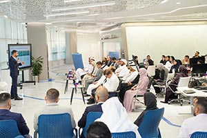
As part of this direction, Dubai Municipality continues to expand surveying works to cover waterways across the emirate in coordination with relevant entities, in preparation for the next operational phase and the broader activation of the project’s outputs. These efforts will support the integration of smart systems and further strengthen the efficiency, resilience, and sustainability of city management.


- Fresh Skin, Glazed Brows: Benefit Cosmetics Has Your Spring Beauty Mood Covere... [2534-Views]
- Beauty Spring Cleaning with Benefit Cosmetics!... [1914-Views]
- Lucky Day Draw Records Second Grand Prize Win as Nepalese Player Claims AED 30... [1409-Views]
- EU261 Reform Misses the Mark on Delays and Competitiveness... [1265-Views]
- 'Make it a Dubai Summer' with the Most Value-Packed Edition Ever of DSS: Enjoy... [1260-Views]
- Emirati AI Experts Prepare to Lead Implementation of UAE AI Strategy 2031... [1123-Views]
- UAE Participates in EBRD Board of Governors Meeting and Reaffirms Support for ... [1095-Views]
- ãÌãæÚÉ ÇáÎáíÌ áÇÓÊÑÌÇÚ ÇáÃãæÇá ÇÓÊÑÏÇÏ ÎÓÇÆÑ ÇáÊÏÇæá ÈÎÈÑÉ ... [997-Views]
- Ministry of Finance Unveils UAE's First Sovereign Retail T- Sukuk Investment O... [993-Views]
- Riyadh Air Opens Ticket Sales for Daily Service between Dubai, UAE and Riyadh,... [970-Views]
- Danube Properties Expands UK Presence with New London Office, Eyes Wider Europ... [914-Views]
- Under the directives of Mohammed bin Rashid Dubai Humanitarian facilitates se... [907-Views]
- Sports Coordination Council discusses sports representation framework, governa... [902-Views]
- Mohammed Bin Rashid Library Emphasises Role of Families in Building Children's... [884-Views]
- UAEREP Kicks Off AI-Driven Research Project on Next-Generation Cloud Seeding M... [883-Views]
- Emirati Developer GAF Property Shapes a New Residential Experience with Flow25... [873-Views]
- Umm Al Quwain Free Trade Zone (UAQ FTZ) Launches Company Migration Programme t... [862-Views]
- Malabar Gold & Diamonds continues its expansion in North America: Launches 8th... [861-Views]
- Under supervision of Smart and Autonomous Systems Council, Abu Dhabi Investmen... [838-Views]
- Etihad Rail Supports the Fishing Sector through the Rail Transport of Fresh Fi... [828-Views]